During the last decades the attention of many European cities has shifted to waterfronts.
They are rather complicated areas of the city as they combine two different realities and their respective actors and dynamics: the harbor and water.


> The Harbor
Traditionally, it is a chaotic place where fishermen drive their bargains, where ferries and ships continuously leave and arrive, with their never-ending streams of people. The fascinating and folkloristic aspect often give in to the bad reputation of the harbor, especially in big cities: a poor and fairly dangerous district.
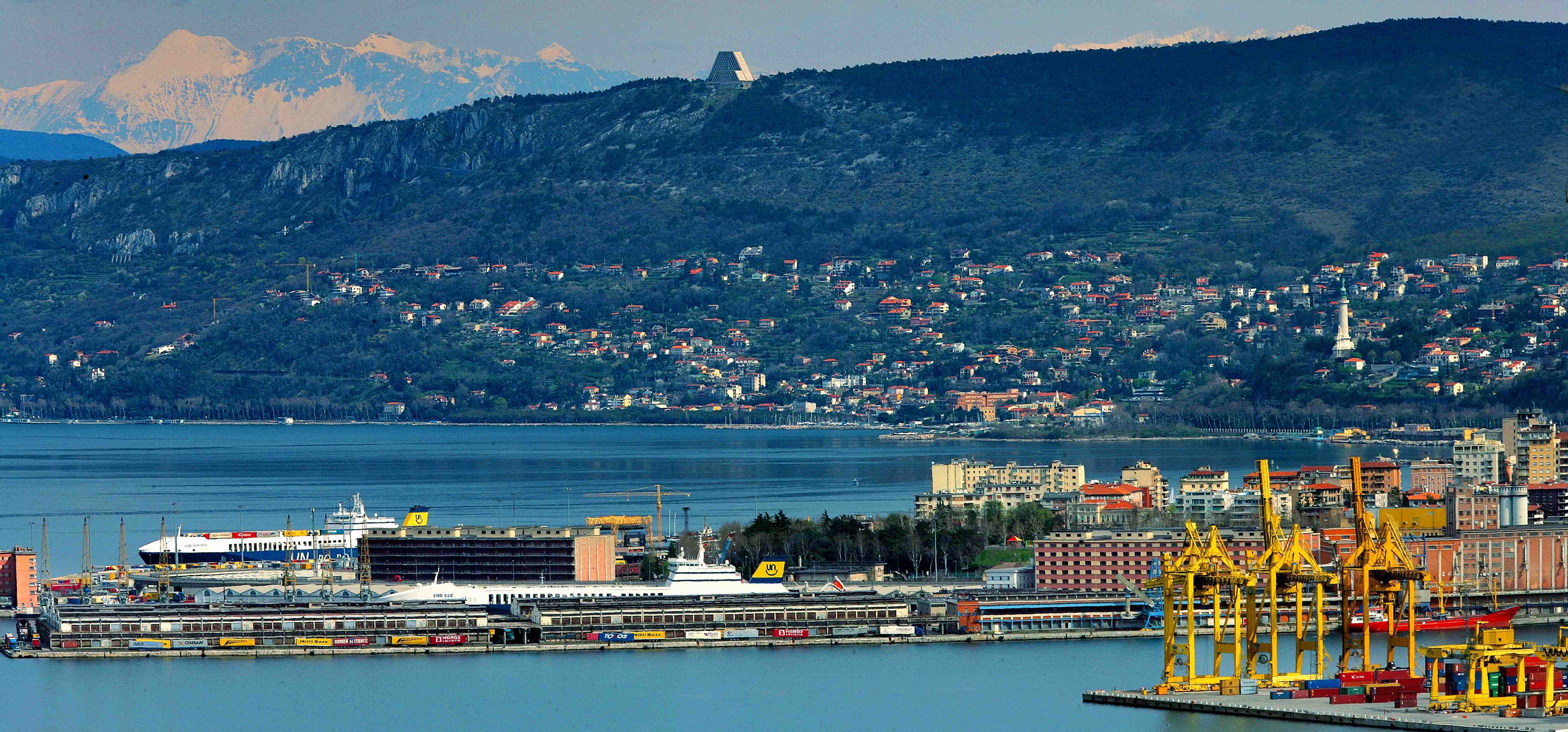
Trieste _ Italy
> Water
Wheather it’s the beach of a hyper-touristic destination or the riverfront of a historical city center, water will always be an extremely attractive urban element, both for tourists and residents.
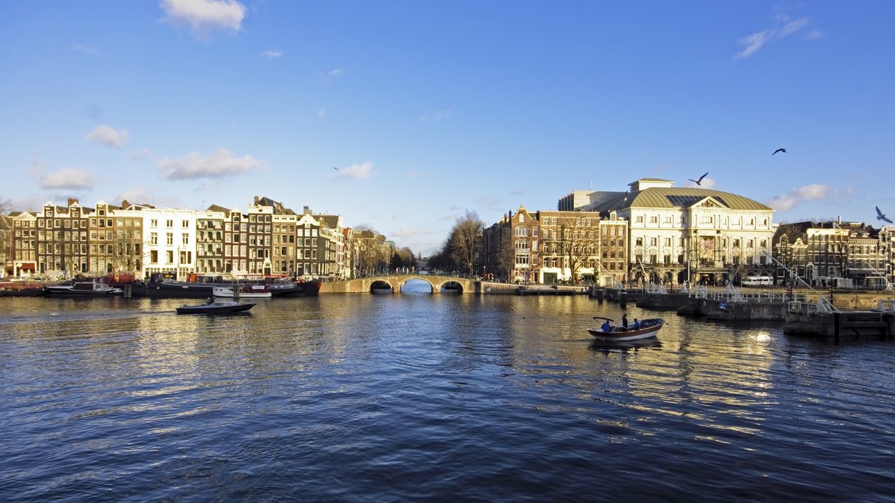
Amsterdam _ Netherlands
Waterfronts are a city’s business card and maybe its most important postcard.
But they can also offer a great opportunity for urban developement, to upgrade forgotten and under-used parts of the city.
Great examples of waterfront design:
Hamburg, a prime example of waterfront and harbor development. Some keywords (water, public, ecology, history, adaptabiliy) and a long-term vision to revitalize a bleak district.
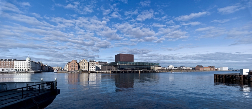
Copenhagen, a masterplan made of iconic volumes connected through the “fil-rouge” of the existing public promenades and open spaces.
Amsterdam, where the reinterpretation of the traditional dutch canal house helps redesign two peninsulas in the city’s docklands.
> HAFEN-CITY in Hamburg <

After the fall of the Berlin Wall and the Iron Curtain, Hamburg’s role in Europe grew impressively, becoming a crucial hub in central Europe. Moreover, with the growing of the Baltic Sea area, the city was able to leverage its connections with northern Europe.
> Hamburg understood its huge potential for development, and quickly decided to exploit it
The idea to transform the borders of the port around the city center was first considered in the 1990s. In that period, port capacity was built up south of the River Elbe, leaving some central areas on the north banks nearly unused. To begin with, they had to take control of the whole area: most art of the lands belonged to the city of Hamburg but buildings mostly belonged to private businesses.

In 1996 the well-known Hamburg architect Professor Volkwin Marq presented his first study on the urban regeneration of the port peripheries, laying down some of the development principles that are being used now (for example, the urban structure and the principle of mixed uses)
> In 1997 Professor Volkwin Marqhe presented “Vision Hafen-City


An area of over 150 hectares was to be developed into an upmarket inner-city mixed use district with residential, work, cultural and leisure; the removal of the HafenCity area from the Port of Hamburg was provided by the simultaneous establishment of a special fund under public law to hold “city and port” assets.
> An ideas competition was launched at the end of April 1999 and an international jury chose the winner in October: Hamburgplan, a Dutch-German team with Kees Christiaanse/ASTOC


> The masterplan was finally approved by the Hamburg Senate in 2000.
Then it was opened to the public. The key points of the masterplan were discussed through a series of exhibitions and events. In the following years, this masterplan has demonstrated to be effective and well functioning. Basically, it can be bescribed by 5 +1 keywords: water, public, ecology, history, adaptability and FORESIGHT.


> Water and buildings
The project set a strong connection between water and building, both under the formal and functional aspect. It takes shape through the accurate design of the borders, but it also conceives the buildings’ elevation as a device to protect the city from potential floods. 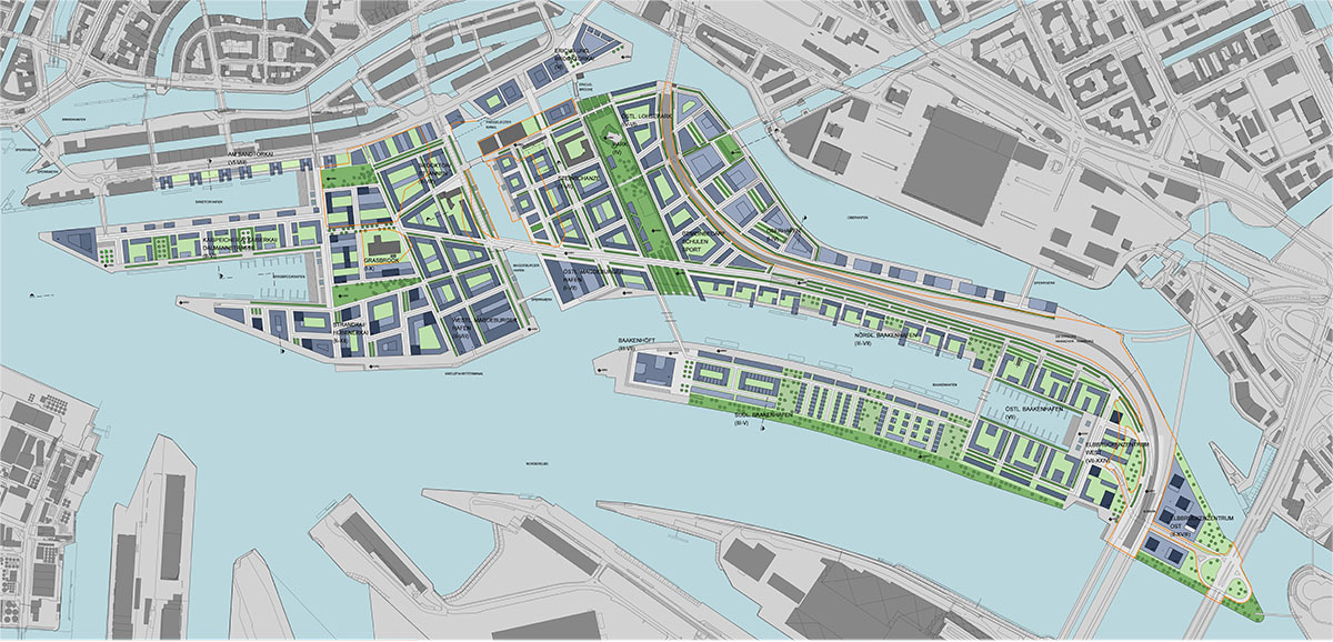
> Attention to the public space
The whole masterplan is woven with a fine-grained mix of uses (dwellings, schools, sport services, …) and many ground floors are designed as public open spaces (parks and green areas).


> Ecology
Noise levels, odours and air pollution were analyzed and calculated in order to reduce them and to create better living-conditions in the new district. Connection to the district heating system, with its existing pipe infrastructure and gas power station, will be a suitable solution for providing electrical power and heating for HafenCity whilst minimising CO2 emissions and conserving Energy. Moreover, the run-off water from roofs and land surfaces will be drained directly into the Elbe and the harbour basins.
> History
Remnants of port and railway architecture are preserved as far as possible in order to help this new part of the city establish a new identity which is consistent with its past, with its history.


> Adaptability
As all other urban transformations, HafenCity needed years to be realized; the projects take actions by different and versatile moves, adaptable to any possible changes that might affect the development process. 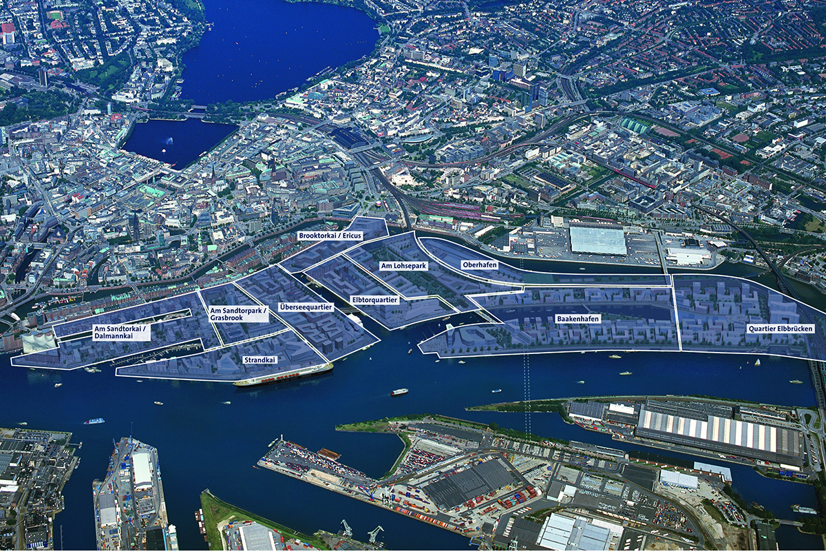
> Foresight
Hafen City can be managed independently but it is planned to influence its neighbourhood, to reach, step by step, a widespread strategy; it is figurehead for a new business, social, cultural and urban economic breakthrough. What takes place in HafenCity is supposed to leave its stamp on Hamburg’s city center for many decades. Foresight is actually the most important aspect of such a big and complex masterplan.


Photos by HafenCity Hamburg GmbH ELBE&FLUT Kuhn – Fotofrizz
> Copenhagen INNER HABOUR <
Everything started in 2000 when the municipality of Copenhagen asked three design studio for a new development of the entire city harbour.. In particular, the studio Henning Larsen Architects was commissioned to make different proposals for the area defined by Knippelsbro and Tolboden.
> The new masterplan changes Copenhagen’s waterfront but also aims to strengthen previously initiated design activities, especially concerning open spaces and public areas
The studio established that the water surface had to be the floor, while the sky had to be the ceiling of the new development. They were asked to design large volumes (buildings) on each side of the harbour.


All these buildings, regardless of function, couldn’t turn their backs to the harbour: on the contrary, they were all supposed to dialogue with the water and to complement the public promenades and squares.
> The Royal Danish Playhouse (design by Lundgaard & Tranberg Arkitekter) and the new Opera (designed by Henning Larsen Architects) are just two bricks of this great ongoing masterplan

")
Photos by Henning Larsen Architects and Lundgaard & Tranberg Arkitekter
> BORNEO SPOREMBURG in Amsterdam <
The architectural firm West 8 was commissioned a masterplan to redesign two peninsulas in the eastern part of the Amsterdam docks. These areas were meant to be exploited for water-related activities and residential functions (about 2500 low-rise dwelling units, with a density of 100 units per hectare).
> West8 suggested a new interpetation of the traditional Dutch canal house: three storey units with ground access, with internal patios and roof gardens.
")
")
")
")
")
")
")
At a small scale, this type was repeated in a great variety of dwelling modes and with the maximum of architectural variation. At a larger scale you perceive the perfect balance between the individual units and the long docks.
> Three huge sculptural blocks become landmarks in this residential area
")
Photos and drawings by West 8

Pingback: WATERFRONTS | Promenades | ARCHISCAPES